How Felixstowe connects to UK motorways: 2026 guide
For logistics operators managing container freight at scale, understanding how Felixstowe connects to UK motorways is not a background concern. It is an operational priority. The Port of Felixstowe handles approximately 40% of the UK’s containerised trade, and its entire road connectivity feeds through a surprisingly finite set of junctions and corridors. The gap between a smooth collection and a nine-hour delay can come down to a single incident at one interchange. This guide covers the primary routes, the current capacity realities, the 2026 infrastructure programme, and the practical strategies that separate reactive hauliers from resilient ones.
Table of Contents
- Key takeaways
- How Felixstowe connects to UK motorways
- Congestion and capacity at critical junctions
- Infrastructure improvements and the 2026 masterplan
- Practical strategies for logistics operators
- Comparing route options from Felixstowe
- My take on Felixstowe’s connectivity realities
- Container haulage from Felixstowe with Jhaulage
- FAQ
Key takeaways
| Point | Details |
|---|---|
| A14 is the primary artery | All major UK motorway access from Felixstowe begins with the A14, feeding west towards the M1, M6, and beyond. |
| Two critical pinch points | Orwell Crossing and Copdock Interchange both operate at or beyond design capacity, creating disproportionate delays. |
| Single incidents cause multi-hour closures | A14 closures near the port have lasted over nine hours, making contingency planning non-negotiable. |
| Infrastructure improvements are planned | Freeport East’s 2026 Transport Masterplan targets the A14, A120, and Orwell Crossing, though funding timelines remain uncertain. |
| Systems thinking protects freight flow | Treat port access as a network of junction-level vulnerabilities, not a single road, to build genuinely resilient dispatch strategies. |
How Felixstowe connects to UK motorways
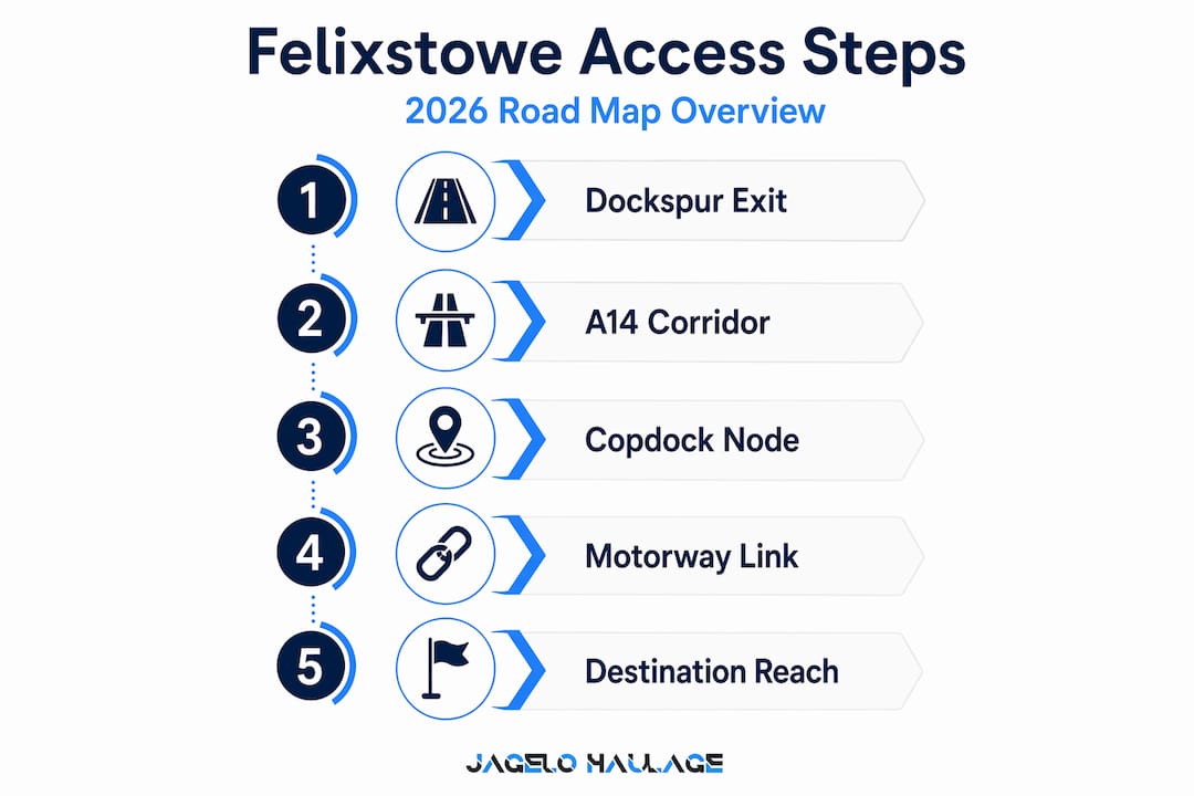
Felixstowe’s motorway access is architecturally straightforward but operationally unforgiving. The entire road network for freight departing the port funnels through the A14 as the principal westward artery, and this single corridor is the load-bearing structure upon which most UK-bound container movements depend.
The A14 originates at the port’s Dock Gate roundabout and runs westward through Ipswich, connecting at key interchanges with the wider motorway network. The most significant of these connections is at Catthorpe Interchange near Rugby, where the A14 meets both the M1 and M6. This junction provides direct access to the Midlands, the North West, and ultimately Scotland via the M6. For freight moving south towards London or the South East, the M25 is accessible via the A12 south of Ipswich, joining the orbital motorway at Junction 28 near Brentwood.
The secondary corridors supporting Felixstowe transport links include:
- A12: Runs south from Ipswich, providing access to the M25 and serving destinations in Essex, East London, and the South East.
- A120: Connects westward from the Harwich area towards the A12 and further inland, offering an alternative routing particularly relevant for freight originating at Harwich International Port but also used by operators seeking to bypass sections of the A14 around Ipswich.
- A1307 and B1078: Minor supplementary routes used tactically during congestion, though unsuitable for consistent HGV use at volume.
Two key nodes govern access at the port end. The Dockspur roundabout controls departure from the main terminal area, while the Copdock Interchange (where the A14 meets the A12 south of Ipswich) represents the first major decision point for freight routing. Operators destined for London and the South East typically divert south onto the A12 at Copdock, while Midlands and northern traffic continues west on the A14.
| Corridor | Direction | Motorway connection | Primary destinations |
|---|---|---|---|
| A14 west | West | M1, M6 at Catthorpe | Midlands, North West, Scotland |
| A12 south | South | M25 at J28 | London, South East, Essex |
| A120 | South-west | A12 junction | Essex, Hertfordshire, North London |
| A14 east | East | Terminal access | Port gates, Felixstowe town |
Congestion and capacity at critical junctions
The structural challenge of Felixstowe motorway access becomes apparent when you examine the actual vehicle volumes at its two most critical junctions. The Orwell Crossing on the A14 accommodates over 65,000 vehicles daily against an original design capacity of 70,000. That leaves less than 8% headroom before the structure is operating at theoretical maximum. The Copdock Interchange, meanwhile, handles approximately 90,000 daily movements against a design capacity of just 60,000. It is operating at 50% above the capacity it was built for.
These are not abstract statistics. They translate directly into the behaviour of freight movements under normal and disrupted conditions alike.
- Small increases in vehicle volume at Copdock produce non-linear congestion effects, where a 10% volume increase can double journey times through the interchange.
- The Orwell Crossing, as a bridge structure, carries additional vulnerability: any incident on the crossing itself removes an entire direction of travel with no proximate alternative.
- Peak port activity windows (typically between 06:00 and 10:00, and again between 14:00 and 18:00) coincide with general commuter traffic, compounding the pressure on both nodes.
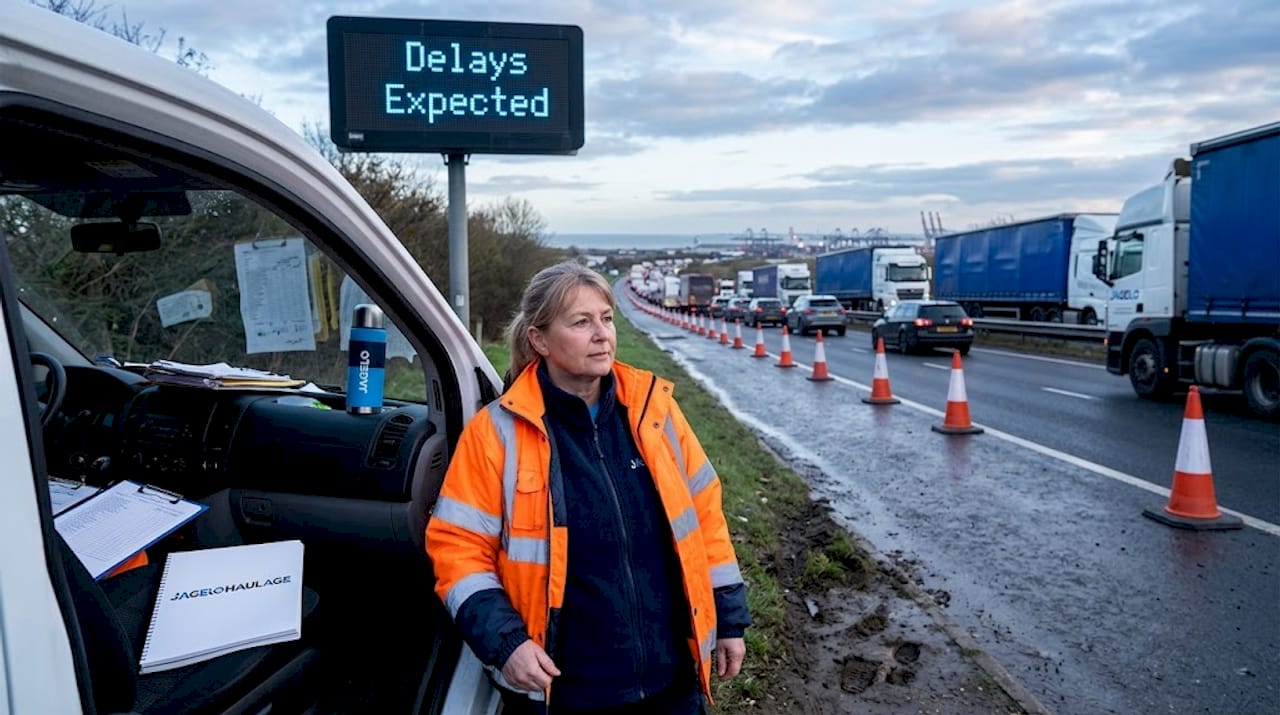
Single incidents on this corridor carry outsized consequences. A crash between the Dockspur roundabout and the Felixstowe Dock Gate roundabout closed the A14 for over nine hours, from early morning into the mid-afternoon. For a haulier operating timed port collections, a closure of that duration does not just delay one vehicle. It cascades through an entire day’s dispatch schedule, potentially triggering detention costs and missed slot penalties under the port’s Vehicle Booking System.
Capacity constraints at these junctions mean that even modest disturbances translate into major delays for freight destined beyond the port area. The implication for dispatch planners is clear: real-time monitoring of these two nodes is as operationally important as monitoring the port itself.
Infrastructure improvements and the 2026 masterplan
The Freeport East 2026 Transport Masterplan has placed Felixstowe’s connecting routes at the centre of a structured improvement programme. The masterplan identifies 14 priority projects, with several directly relevant to the A14 and supporting corridors used by port freight.
The headline priorities for road and rail connectivity include:
- Orwell Crossing resilience works: Addressing both structural capacity and incident management to reduce the frequency and duration of closures on this critical river crossing.
- Copdock Interchange upgrade: Reconfiguring the junction geometry to increase throughput and reduce the cascading congestion that currently radiates back towards the port gates.
- A120 corridor improvements: Upgrading the route between the A12 and the port region to provide a more reliable secondary corridor, particularly valuable when the A14 is disrupted.
- Ely Rail Improvement Programme: Expanding rail freight capacity through Ely to support modal shift, reducing HGV volumes on the A14 by transferring a portion of port freight to rail.
- A14 corridor maintenance works: Resurfacing and drainage renewal between junctions 36 and 42 (Cambridge to Bury St Edmunds), scheduled through 2025 into 2026, improving structural reliability across the freight corridor.
The Ely rail component deserves particular attention. Sustainable freight capacity growth at Felixstowe depends on a combined approach where road upgrades and rail modal shift work in parallel. Without increased rail capacity, road improvements alone will be absorbed by growing container volumes within a few years.
Pro Tip: Treat all masterplan timelines as best-case projections. Funding and delivery approvals for individual projects remain subject to government sign-off, meaning the sequencing and completion dates of these works could shift materially. Build your medium-term freight planning around current infrastructure constraints, not anticipated improvements.
Practical strategies for logistics operators
Understanding the physical road network is the foundation. Converting that understanding into operational resilience requires a different discipline. Here is where many freight operators fall short: they treat the A14 as a single route rather than a system with distinct junction-level vulnerabilities, each with its own risk profile.
The following strategies reflect the operational realities of the current network:
- Map your exposure at junction level. Know which of your regular routes pass through Copdock Interchange and Orwell Crossing. Any collection or delivery slot that relies on transit through either node carries a quantifiable disruption risk that should be reflected in your scheduling buffers.
- Maintain documented diversion protocols. For southbound freight that would normally use the A12 via Copdock, establish a pre-approved alternative via the A14 further west before diverting south. For northbound freight, ensure drivers have validated HGV-suitable routing via the A1 as a backup to the A14/M1 option.
- Integrate real-time traffic monitoring into dispatch decisions. Tools that provide junction-level telemetry, such as those offered by fleet telematics platforms, allow dispatchers to make informed hold-or-go decisions before committing a vehicle to a disrupted corridor. The cost of a 45-minute hold at a truck stop near Felixstowe is negligible compared to nine hours of stationary detention on a closed A14.
- Time collections around port activity cycles. Where your Vehicle Booking System slots allow flexibility, scheduling collections outside the 06:00 to 10:00 and 14:00 to 18:00 peak windows reduces your exposure to compounded port and commuter traffic at Copdock and the Orwell Crossing.
Pro Tip: Effective logistics management for Felixstowe requires building junction blockage scenarios directly into your standard operating procedures. A closure lasting several hours is not an exceptional event on this corridor. It is a foreseeable risk that your scheduling, driver communication, and customer notification processes should already account for.
Comparing route options from Felixstowe
For operators who move containers to diverse destinations across the UK, understanding the relative characteristics of each corridor is a prerequisite for effective container haulage planning.
| Route | Congestion risk | Design capacity status | Improvement timeline | Best suited for |
|---|---|---|---|---|
| A14 west (to M1/M6) | High at Copdock and Orwell | Exceeded at both nodes | Masterplan priority, funding TBC | Midlands, North West, Scotland |
| A12 south (to M25) | Moderate to high | Operates near capacity | A120 works may provide relief | London, South East, Essex |
| A120 west | Moderate | Below capacity | Corridor upgrades planned | North London, Hertfordshire, bypass of A14 |
| A14 maintenance zone (J36-42) | Variable during works | Affected by active works | Works ongoing into 2026 | Through freight to Cambridge and beyond |
The A14 westbound remains the dominant route for volume and reach, but its dual pinch points make it the highest-risk corridor during incidents. The A12 southbound via Copdock carries similar junction-level exposure at the interchange itself, though the A12 south of Ipswich generally flows more freely than the A14 west. The A120 is the most underutilised corridor given its current capacity headroom, and operators running freight to north Essex or seeking to enter the A12 south of Chelmsford should consider it a genuine primary option rather than a diversion of last resort.
My take on Felixstowe’s connectivity realities
I’ve spent considerable time working with operators who assume that once a container leaves the port gate, the hard part is over. In my experience, the stretch between the Dockspur roundabout and Copdock Interchange is where freight plans succeed or unravel.
What I’ve learned from working through numerous disruption events on this corridor is that the operators who maintain schedule integrity are rarely the ones with the fastest trucks. They are the ones who planned for the constraint. They modelled what happens when the Orwell Crossing closes. They tested their diversion routing before they needed it. They briefed their drivers on hold procedures rather than leaving them to improvise on a closed carriageway.
The 2026 masterplan is genuinely encouraging. The Ely rail improvements in particular could change the calculus for high-volume shippers if they deliver as specified. But I would caution against adjusting your operational posture today based on infrastructure that has not yet been funded and approved. The masterplan signals intent. The A14 at peak time signals reality.
My recommendation is to treat Felixstowe’s road connectivity as a critical system operating at its limits, because that is precisely what the data shows. Copdock at 150% of design capacity is not a minor inconvenience. It is a structural constraint that demands structural responses in your planning. Build the buffers. Monitor the nodes. Know your alternatives before you need them.
— Vytautas
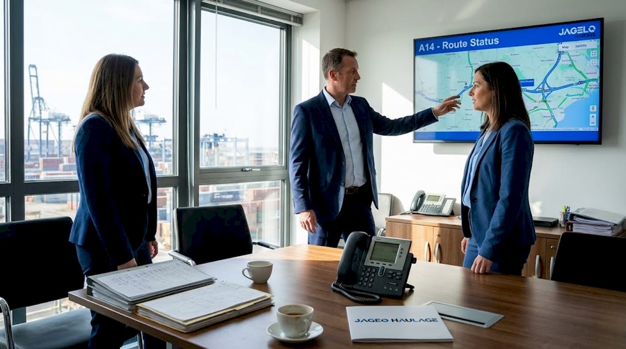
Container haulage from Felixstowe with Jhaulage
For logistics and freight forwarding operators who need reliable container movements from Felixstowe, knowledge of the route network is only part of the equation. Execution matters equally.
Jhaulage operates a fleet of over 40 GPS-tracked trucks and trailers, with specialist expertise in container haulage from Felixstowe and the UK’s other major deep-sea ports including Tilbury, Southampton, and Liverpool. The team understands the junction-level constraints discussed throughout this guide, and dispatch decisions are informed by real-time traffic monitoring rather than assumptions about corridor availability. Whether you need port-to-door container haulage for a single FCL movement or a dedicated programme to manage high-volume port collections, Jhaulage offers 24/7 operational support and the route knowledge to keep your supply chain moving when the A14 does not. Contact the team to discuss your Felixstowe freight requirements.
FAQ
What is the main motorway route from Felixstowe?
The primary route is the A14, which runs westward from the port and connects to the M1 and M6 at Catthorpe Interchange near Rugby, providing access to the Midlands, North West, and Scotland.
Why is Copdock Interchange a problem for Felixstowe freight?
Copdock Interchange currently handles approximately 90,000 daily vehicle movements against a design capacity of 60,000, meaning it operates at 50% above its intended limit and generates disproportionate delays during any disturbance.
How long can A14 closures near Felixstowe last?
Single incidents between the Dockspur roundabout and the Felixstowe Dock Gate roundabout have closed the A14 for over nine hours, making contingency planning and diversion protocols operationally necessary rather than optional.
What improvements are planned for Felixstowe motorway access?
The Freeport East 2026 Transport Masterplan prioritises upgrades to the Orwell Crossing, Copdock Interchange, and the A120 corridor, alongside the Ely Rail Improvement Programme to shift freight to rail, though funding approvals remain subject to government confirmation.
Is there an alternative to the A14 for freight leaving Felixstowe?
Yes. The A12 south via Copdock provides access to the M25 for London and South East destinations, while the A120 offers a viable secondary corridor for north Essex and Hertfordshire, particularly when the A14 is congested or closed.
Recommended
- Reliable Container Haulage from Felixstowe: A Guide to Port Logistics | Jagelo Haulage
- Reliable Container Haulage from Felixstowe Port: A Strategic Logistics Guide | Jagelo Haulage
- Container Haulage from Felixstowe: A Professional Guide to Port Logistics | Jagelo Haulage
- Felixstowe Container Haulage That Keeps Pace | Jagelo Haulage